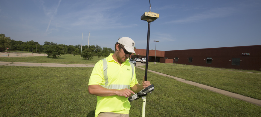
Surveying is essential to land development. One of the oldest known professions, surveyors originally determined property boundaries and measured and mapped the land. Today’s surveyors still do that, dealing with the land people own, topography, and elevation. They help us understand how to best work within the available land and constraints, accurately plan and design for a project, and establish constructability.
Expertise is more than just knowledge — it requires making the connections that others miss, answering the “why” and “how” questions. The Surveying Department at BG Consultants explains complicated circumstances so that you can clearly understand the situation and available options.
Surveying Services
Property Boundary/Rights Surveys
Whether you are buying or selling, have a boundary dispute or just want to know the location of your boundaries, our surveyors can help. Boundary surveying has been the cornerstone of our surveying department since the firm was founded. Our first project was a boundary survey, and land boundaries continue to play a role in nearly every project we undertake.
- Boundary Surveys
- ALTA/ACSM Surveys
- Condominium Surveys
- Legal Descriptions
- Easements
Construction Surveying
BG has been building successful relationships with contractors who need assistance translating a plan from paper to the real world, as well as project owners who need to verify a project was built correctly. We understand that time is money, and know how important it is to “do it right the first time” versus “ripping it out and starting over again.”
- Construction Staking
- As-Built/Construction Verification Surveys
Development
Zoning regulations, homeowners associations, construction documents... Land development can be a lengthy and complicated endeavor full of red tape, but our surveyors can help every step of the way. From prospecting potential project site locations to the sale of fully-developed lots, our team has development down to an art.
Elevation Surveys
Everyone knows the three most important considerations when dealing with property are “Location, Location, and Location.” However, many forget that one of those “locations” is elevation. New technologies allow FEMA to map potential Hazard Areas more accurately than ever before. Unfortunately, many areas previously thought to be excluded from Special Hazard Areas and buildings constructed in reliance upon the previous maps may now be at risk. BG's surveyors understand the importance of protecting the investment you have made in your property and are experts at finding solutions to your property protection needs.
- Elevation Certificates
- Letter of Map Amendment (LOMA)
- Letter of Map Revision (LOMR)
Environmental Engineering Surveys
“Environmental Impact” is a common buzzword in all forms of news media these days. The first step to understanding environmental impact is determining “how much” of “what” is located “where.” And that means our surveyors getting a little dirty. But don’t worry about us — we know what we are doing because we’ve “stepped in that before!”
- C&D Landfill Surveys
- Sanitary Sewer Lagoons
Transportation Engineering Surveys
Transportation is all about motion. If it’s not moving forward, it’s moving backwards. Our surveyors understand that interruptions to the flow of traffic are much more than a hassle — they can be life-threatening, dangerous hazards. We use the latest equipment and techniques, combined with safety-conscience protocol and innovative scheduling, to minimize the impact of our survey to the length of your commute and minimize the opportunity for your vehicle to impact our surveyors.
Utility Surveys
Regardless of whether your personal style is simplistic or elegantly refined, the truth is that ours is a utilitarian society. Without vital connections providing water, energy, and communications and removing waste products, our civilization would grind to a halt. Utilities are everywhere: along the highway, in the alley, between houses, under the ground, in the air…and more are installed every day. Whether you need a map of existing utilities or need to weave another line through the utility spaghetti, our surveyors are here to help.


